Thursday, April 27, 2006

Glen Cove Marina and Carquinez Bridge

The following pictures are from around Vallejo area.


Panorama of Glen Cove Marina


A bigger Panorama of Glen Cove Marina. Includes Mt Diablo, C&H SUgar factory and Carquinez Bridge.

The pictures below are taken from Crockett. The Carquinez Bridge connects Vallejo to Crockett. The middle span is in the process of being taken down.


Saturday, April 08, 2006

Fort Funston in San Francisco

I was in Daly City today, and I took advantage of the great weather to go to Fort Funston in San Francisco. It's a place where people go hang-gliding. The wind wasn't suitable for that when I got there, but I had a chance to take pictures of people flying their RC planes, as well as hang gliders parked on the ground.


Wednesday, March 29, 2006

Mission Peak

I went to SD West software conference a couple of weeks ago in Santa Clara, and on my way there I noticed this sea of bright yellow flowers along I-680 on Fremont, in front of Mission Peak. I figured it's a perfect place to test my new camera. I went back there the following weekend armed with my camera and allergy pills. Here are the shots from that outing.

Here are a couple of shots of Mission Peak from the field.


While shooting, I noticed these buzzing sounds and drove down the street to check out what it was. The sound was coming from Bayside R/C Club airfields. There, kids and adult alike where driving RC cars, planes and helicopters. They actually have their own airfield!


This picture is a panoramic view of Mission Peak from Warm Springs Rd.


I then drove up towards Mission Peak and found this nice view of Fremont and the Bay Area. The two hangers from far away are from Moffett Field in Mountain View, about 10 miles away.

Vallejo Panorama

I took this a couple of weeks ago but when I tried posting it, blogger would resize it. Today, I finally found a free site that would host it's full size.

Click on the image to see the fullsize.

The shot was taken from a rest area in Vallejo. The center of image faces south. The mountain right above the trees on the foreground, 1/4 from the left is Mt Diablo in Danville. Sutro Tower in San Francisco is a little bit to the right of center, and so are the two towers of Golden Gate Bridge. The big mountain on the right is Mt Tam (Mt Tamalpais) in Marin County. Also visible on the right is Six Flags Marine World.


Monday, March 27, 2006

Pleasanton Pics

I thought it was going to rain early today, but when I looked outside and it was still sunny, I grabbed my new camera and drobe around Pleasanton to take some pictures. I forgot to take my allergy pills so I paid for it afterwards, but some of the pics I took turned out nice.

Around the Park


Trees and Roots


Ranch


Wednesday, February 15, 2006

Chinese New Year Parade

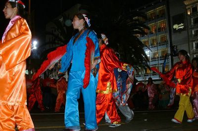
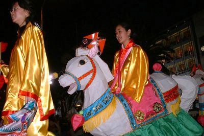
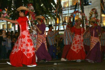
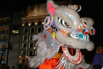
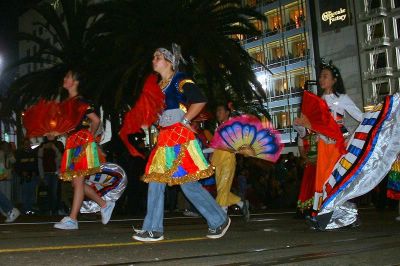
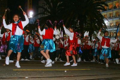
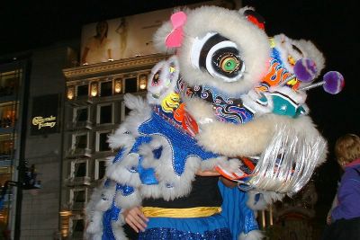
This year's San Francisco New Years Parade went really well. The weather was really nice and sunny during day time and it wasn't too cold at night.

I went to the city around lunch time and decided to take advantage of the nice weather by taking some pictures and doing some walking. I went to Embarcadero's Farmer's Market, and then to Chinatown, where a sea of people shopped at street vendors.

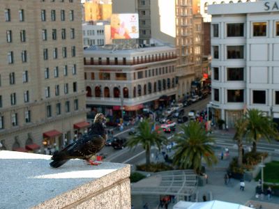
Afterwards, I went to a Chinese restaurant at Powell for lunch and then went to Union Square to relax and take pictures. I decided to take the elevator up to Cheese Cake Factory to get a better view of Union Square. I've forgotten how nice the view is from up there.

From there I noticed that people were starting to line up along Powell and Geary for the best view of the parade. I then made my way down and grabbed a nice spot in front of the Sir Francis Drake Hotel. I had to sit there with my MP3 player a good two hours before the parade to get a nice spot.

Below are Pics (As always, click to see a larger image):


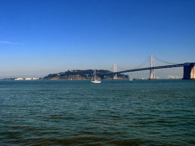
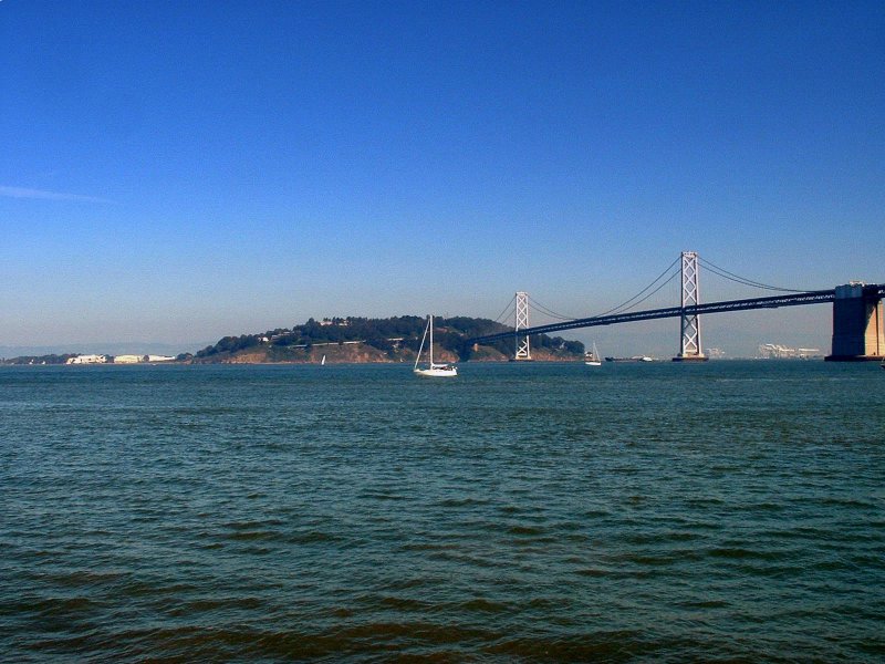
Bay Bridge and Yerba Buena Island from Embarcadero


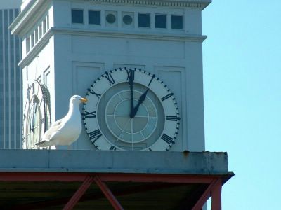
Perfect timing on this seagull


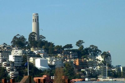
The famous Coit Tower


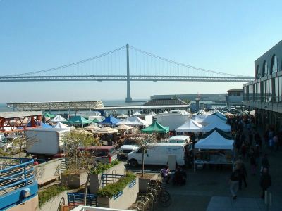
Farmer's Market and Bay Bridge


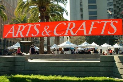
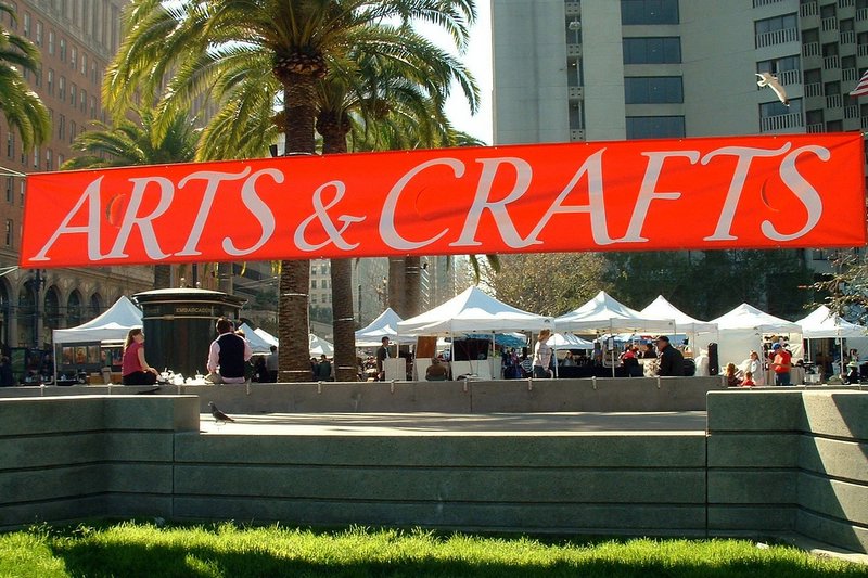
Arts & Crafts on Market and Embarcadero


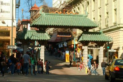
Entrance to Chinatown


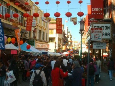
Chinatown street vendors


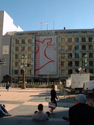
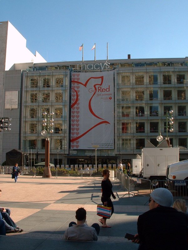
Macy's on Union Square. The top "Macy's" logo is where the Cheese Cake Factory is located.


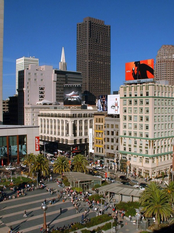
View of Union Square from Cheese Cake Factory. In the center is a granite column commemorating Admiral Dewey's Spanish-American War victory at Manila Bay with a Victory statue modeled after Mrs. Adolph de Bretteville Spreckels, a San Francisco benefactress.


Corner of Post and Stockton, where you'll find Niketown


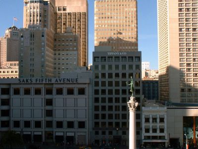
Saks, Tiffany and the Victory Statue


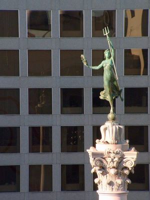
More of that Victory Statue


Corner of Powell and Post, where you'll find the Disney Store


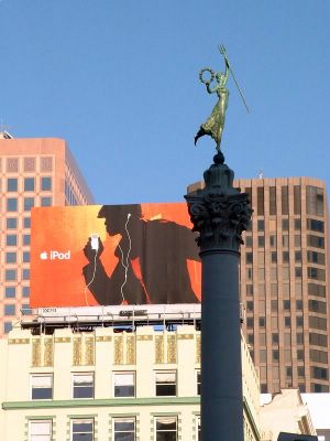
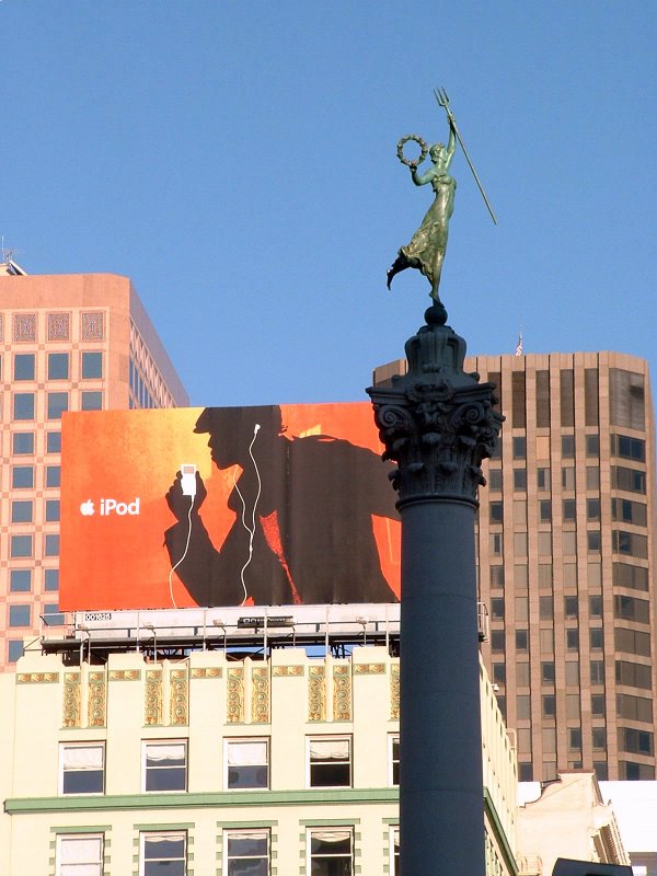
iPod Ad, and more of that Victory Statue


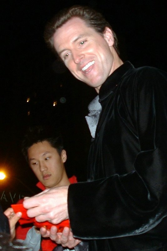
The famous Mayor Gavin Newsom. I shook his hand the second time. The first time was during the Chinese New Year Parade two years ago, a couple of days before he tried to legalize Gay Marriage in SF.
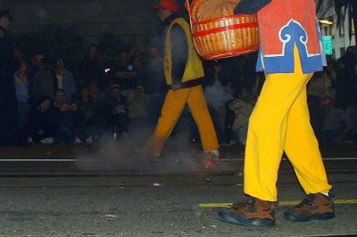
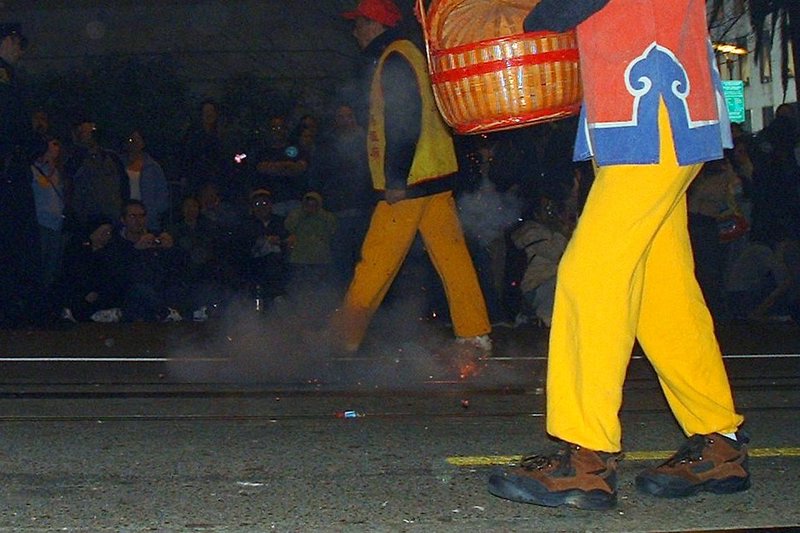


Firecrackers!